Geology Challenge
Picture a giant bulldozer inching its way southward from the Canadian Shield, carrying with it mountains of loose rock, sand, and cobble locked up in its icy grip.
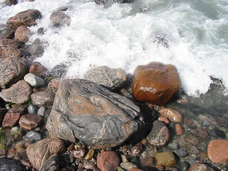
Every square inch of the park has been influenced by the dynamic interactions of water and this glacial material which has been molded by wave action and shaped by the wind to create the landscape we know as Awenda today.
This self-guided hike, supported by an interactive Map, will direct you to a series of 10 stops along the Park’s shoreline. Each stop has a corresponding QR Code. Using your smartphone’s or tablet’s camera, scan the QR code at each stop to uncover part of Awenda’s recent geological history!
The stop of this self-guided hike can stand alone or be completed together. The total distance is 4 km which will take approximately 2 hours to complete.
Please make sure you have water, sturdy footwear, and appropriate weather protection if you choose to complete the entire hike. We hope you do because the beach is a rockin’ place to be!
Let’s Get Started: Head to Stop #1
- Drive down to the beach and park in the first available parking lot.
- Take one of the footpaths down to 1st Beach.
- When you reach 1st Beach walk to the far eastern end of the shoreline (the far right end when facing the bay).
- Find the wooden post labelled Stop #1, and click on Next Up: Stop #1 below.
Interactive Map
Up Next: Stop #1
Bonus: What fun time would be complete without a little music? Can you count how many classic ROCK and ROLL musical acts are referred to throughout the hike? Answers are provided at the end of the challenge.